
john in la
Well-known Member
I really love seeing pictures from different parts of the country; so hope you may find this interesting. I travel this route about once a week with work.
You turn off the 4 lane highway and still are 70 miles from the coast. One way in and one way out. You leave behind all the sugar cane fields and head into what feels like a different country because while all can speak english many of the locals still use french among friends.
If you are in a heavy truck you need to watch what bridges you use because many are pontoon floating bridges that will not support heavy weight. Kind of neat to see them open the draw bridge because it floats out of the way rather than lifting out of the way.

While you will see some tractors as you pass cattle ranches you will mostly see boats. This is a big oil support or fishing area.


You can even see some air boats. I have seen one a oil company owns (not this picture) that is used as a ambulance. Powered by a race car motor.

As you get closer to the coast you notice the buildings get farther off the ground.

Once you get outside of the hurricane protection levee even mobile homes are raised way off the ground.

This close to the coast where trees do not grow it looks like one big grass field.

But once you get on the bridge that crosses the intercostal waterway you can see it is mostly water.

Still 10 miles from the coast but you can see the town as it takes shape in the distance.


You pass a town of a few hundred people since most of the workers drive in but do not live here. This is a big sea port for oil rigs in the gulf.

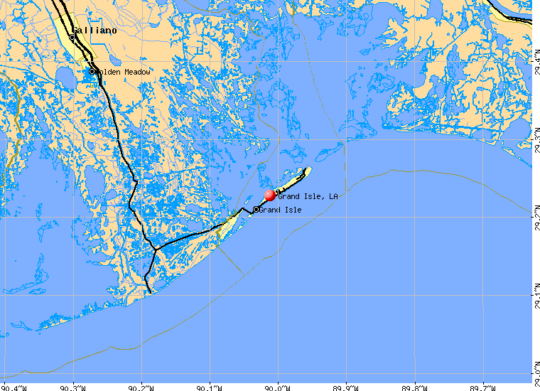
You have now reached the end of the road and you are on a barrier island in the gulf. This is a town of about 1500 that swells to over 25,000 people in the summer time.
You turn off the 4 lane highway and still are 70 miles from the coast. One way in and one way out. You leave behind all the sugar cane fields and head into what feels like a different country because while all can speak english many of the locals still use french among friends.
If you are in a heavy truck you need to watch what bridges you use because many are pontoon floating bridges that will not support heavy weight. Kind of neat to see them open the draw bridge because it floats out of the way rather than lifting out of the way.
While you will see some tractors as you pass cattle ranches you will mostly see boats. This is a big oil support or fishing area.
You can even see some air boats. I have seen one a oil company owns (not this picture) that is used as a ambulance. Powered by a race car motor.
As you get closer to the coast you notice the buildings get farther off the ground.
Once you get outside of the hurricane protection levee even mobile homes are raised way off the ground.
This close to the coast where trees do not grow it looks like one big grass field.
But once you get on the bridge that crosses the intercostal waterway you can see it is mostly water.
Still 10 miles from the coast but you can see the town as it takes shape in the distance.
You pass a town of a few hundred people since most of the workers drive in but do not live here. This is a big sea port for oil rigs in the gulf.
You have now reached the end of the road and you are on a barrier island in the gulf. This is a town of about 1500 that swells to over 25,000 people in the summer time.
")