
You should upgrade or use an alternative browser.
- Thread starter David G
- Start date
Brendon Warren
Well-known Member
Donald Lehman
Well-known Member
Part Time Pete
Well-known Member
- Location
- Leatherstocking Region NY
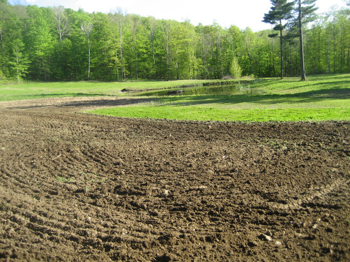
When I was a kid, I was out with one of my buddies one night, and he asked me what I did that day - I said picked rock - he said, what's picking rock?
He lived on a farm that was all bottom land - never picked stone in his life..
Pete
Russ from MN
Well-known Member
- Location
- Bemidji MN
The rocks aren't bad. It's the ledge that's the problem. A guy once asked me why we used open ditches instead of tiling the fields. Pretty hard to tile a field where you might head 40 feet in one direction and hit a ledge that creeps up to sunlight and then hit another at right angles 10 feet away, and another in another direction. My ditches don't curve because of artistic inclinations!
Catskill Pete
Member
coonie minnie
Well-known Member
A rocky farm probably was a lot better than no farm, serving in the king's army, and not having someone else's beliefs as the only choice.
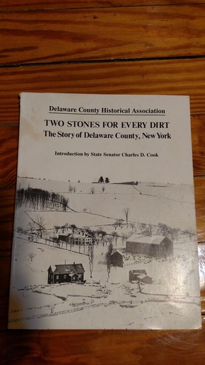
I am trying to remember the stories I was told by old timers in terms of how the area opened to settlement. It seems to me that the precursor to US20 here was open before the Revolution and extended to Western Cayuga County. The locals made use of the area rivers such as the Seneca and Clyde Rivers to open the Central-West Finger Lakes settlement just after the Revolution. The first settlers crossed the Genesee River somewhere close to Scottsville around 1800 but were for the most part subsistence farmers. The Wadsworth Family was important in opening up the Genesee Valley from Mount Morris north. If anybody knows different then please speak up.
db4600
Well-known Member
You hit the nail on the head there. It's much the same in central MN. If you look at the old architecture you can see how that followed the settlers from the Old Country. The folklore here is how a certain group of immigrants got involved in building several area churches. The churches themselves represent the traditions from the Homelands. In Stearns co. when you see a double spired church it is known that the area was settled by Bavarians. The homeplace had plenty of rocks. Enough that the classmates of the kids always made some pocket cash for weeks in the spring picking rocks. The neighborhood I grew up in eventually had 4 neighbors with rock mechanical rock pickers on the hillside of the lake. Everybody there knows what a "stone boat" is.
Bob Bancroft
Well-known Member
- Location
- Aurora NY
Indeed, in this Finger lakes area the natives held on until Gen. Washington got tired of them assisting the British, and he sent the Clinton and Sullivan campaign to wipe them out. Loren/ACG is well versed on his part of that campaign.
Catskill Pete
Member
Hendrik
Member
I know that many settled in Pella, Iowa (led by Rev. Vanraalte) and also in Holland, Zeeland, Grand Rapids and Lansing in Michigan.
Hendrik, from The Netherlands
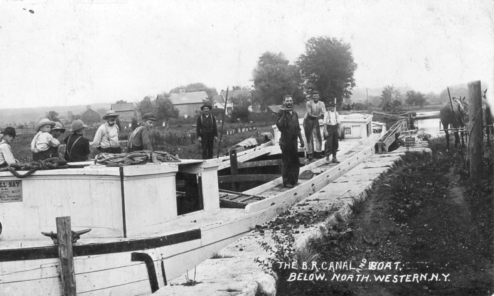
(quoted from post at 14:43:41 03/02/16) Don't forget the other canal that opened up a lot of upper NY. The Black River canal. There are several listings of how long it was. Seventy seven miles is pretty close because part was canal and part was river. Had 109 locks and opened up the entire NE region of NY state to logging and agriculture. What is neat is how much of it is still there today. Most is dry but near Boonville and some others are boatable. Almost a 1200 foot climb up and down from Rome to Carthage, NY. Museum at Boonville. It closed down in 1923 or so after almost 100 years of operation. Again there are disputes in the web sights and books. Today we think nothing of going out with a bulldozer and building a road here to there with the snap of our fingers. A CANAL is a kind of little river. It has to be flat and if you need to go up and down hill you need locks. ALL of this stuff was built with mussel power. Google it up.
Theres a documentary out there on the Black River Canal Good stuff. There were other canals, like the Hudson River-Lake Champlain canal, that are still in use today.
Similar threads
We sell tractor parts! We have the parts you need to repair your tractor - the right parts. Our low prices and years of research make us your best choice when you need parts. Shop Online Today.
Copyright © 1997-2024 Yesterday's Tractor Co.
All Rights Reserved. Reproduction of any part of this website, including design and content, without written permission is strictly prohibited. Trade Marks and Trade Names contained and used in this Website are those of others, and are used in this Website in a descriptive sense to refer to the products of others. Use of this Web site constitutes acceptance of our User Agreement and Privacy Policy TRADEMARK DISCLAIMER: Tradenames and Trademarks referred to within Yesterday's Tractor Co. products and within the Yesterday's Tractor Co. websites are the property of their respective trademark holders. None of these trademark holders are affiliated with Yesterday's Tractor Co., our products, or our website nor are we sponsored by them. John Deere and its logos are the registered trademarks of the John Deere Corporation. Agco, Agco Allis, White, Massey Ferguson and their logos are the registered trademarks of AGCO Corporation. Case, Case-IH, Farmall, International Harvester, New Holland and their logos are registered trademarks of CNH Global N.V.
Yesterday's Tractors - Antique Tractor Headquarters
Website Accessibility Policy