OT OT OT Missouri River flood damage

omahagreg

Well-known Member
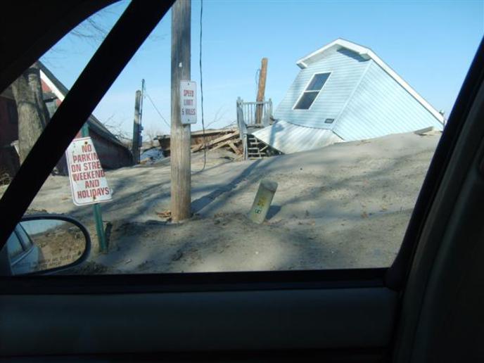
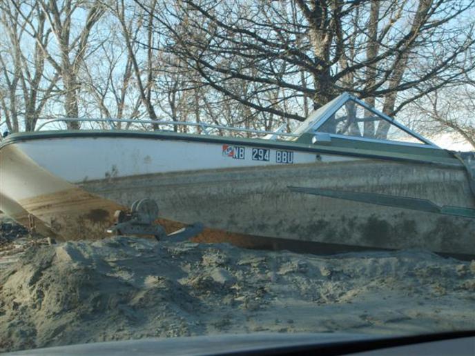
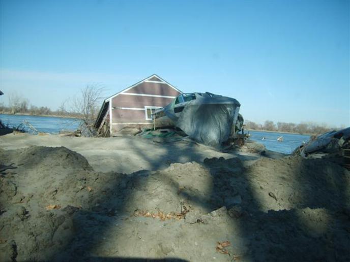
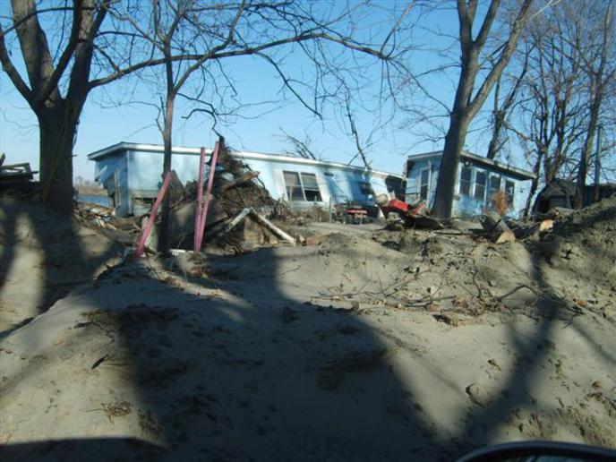
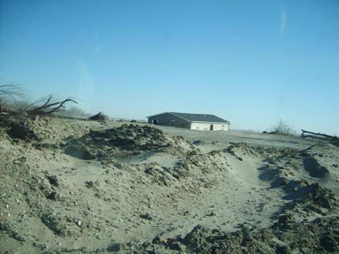
Record snow fall in Montana caught the Army Corp of Engineers with their reservoirs full, SO, everyone down river got this! These pictures were taken yesterday (Nov 23, 2011), about 4 miles east of Fort Calhoun Nebraska. The way the crow flies, this would be less than 1/2 mile from the Missouri River channel.

040.jpg


041-1.jpg


039-1.jpg


038-1.jpg


037-2.jpg
 

Yep thanks to the Corp of engineers and their practice of selective flooding.

If you remember in early spring they had that mess down by Cairo (I think it was) where the Corp’s blew levies to flood farmland rather that the town because the rivers were high down there. The Corps didn’t start releasing significant flows from the Dams in the upper Missouri river basin to spare those people downstream. In my opinion they chose a latter release of massive flow rates in order to spare the downstream cities on the Missouri and Mississippi rivers knowing full well the devastation it would cause in Iowa and Nebraska. I just don’t believe they are so dumb they didn’t know what would happen.

The rain fall in the upper basin may not be predictable but they sure as heck knew how much snow fall there was in the mountains. Another question I have is why were the Dam’s kept so full in the winter anyway?

Ok thats all now!! End off Rant.
 
For winter recreation, they also didn't tell you they were protecting the nesting habitat of a couple of (endangered?) birds, also if they lowered the water too much in the winter they were afraid of major ice dams destroying bridges.
 
So the Game and Fish Dept of SD can keep the walleye season open year round, seel millions of dollars of licenses to non residents. So the Marinas and motels and restuarants in the river cities can make money.
 
That flooded farm land you mention is in a spillway designed to relieve pressure on the river.
 
Good photos. Should of gotten some of the center pivots with sand up to the spray nozzles, and the fifteen foot deep washouts in the middle of 5K per acre cornfields. River floodplain yes, but 500,000 acres of it? Does not pay to say much about the corp in this area.
 
Yep mother nature is boss. What made it even worse is that it wasn't just a flood, the water held that level for 2 months or more! Up here in Sioux City they figure it cut the river channel deeper by 3 feet, a lot less than the expected 6 to 10 feet.
 
(quoted from post at 01:32:05 11/25/11) That flooded farm land you mention is in a spillway designed to relieve pressure on the river.


All I know about the situation is what I hear or read from the news media. I am going to try to attach to a link about the dynamiting of the levee incident I referred to.

Did the Corps make the right decision? I don’t know just saying they did not let the system work as designed.

Was the design whacky to begin with? Seem strange the flood plane was designed so the towns would flood before a “designed Spillway”. Just saying.

[http://www.bloomberg.com/news/2011-...-mississippi-levee-to-divert-flooding-2-.html
 
so the marinas can make money? across nebraska all the marinas were closed all year due to high water, the restaurant at blair washed away! 5 of the Missouri River bridges were closed from 2 - 6 months due to high water! Interstate 29 and Interstate 680 at Council Bluffs Iowa was closed for six months, the national news media didn't even notice. Around here the feeling is, the corp of engineers manual is written in crayon and that is being generous.
 

We sell tractor parts! We have the parts you need to repair your tractor - the right parts. Our low prices and years of research make us your best choice when you need parts. Shop Online Today.

Back
Top